定价请咨询
加载中…

网站月访问量估算
数据为该域名的 Similarweb 流量估算,不是活跃用户数。仅展示有数据的统计月份;采集时间与流量统计月份分别标注。
采集于 2026年11月11日

这是编辑给出的评估,满分 5 分,不是用户打分的平均值。 本页的各方观点由 AI 根据产品信息归纳,不是真实用户的评价。
根据 OpenAITools.app 于 2026-11-11 核对的流量数据,FlyPix AI(flypix.ai)是一个收录在 AI For Data Analytics 下的 AI 平台,月访问量为 8.64万,月度环比流量变化为 +1.1万(+14.6%)。其主要地理市场为巴西(11.4% 流量份额),采用免费增值,免费试用,付费定价模式。按月流量计算的主要竞争替代方案包括 EOS Data Analytics(72.08万次访问/月),Picterra(562 次访问/月),Ultralytics(79.34万次访问/月)。
零代码训练卫星图目标检测模型,效率直接拉满。
处理高分影像挺顺手的,就是大项目费用吃不消。
专业遥感神器。
免费额度有点少,稍微跑几张图就见底了。
以下短评基于实时网页探查、定价机制与同类产品基准由 AI 综合模拟生成,旨在呈现不同使用场景下的常见槽点与亮点,非实名真实用户评价。
直接在浏览器中标注样本,为任何可见目标训练专属检测器,无需编写代码或配备机器学习专家。
把训练好的模型变成按计划反复扫描新影像的智能体,让变化被自动发现,而不是靠碰运气。
在同一工作空间管理来自多种来源和分辨率的影像,包括正射影像和常见地球观测数据源的栅格数据。
应对目标密集、场景复杂的影像,同时输出可用于量测、计数和导出的检测框与轮廓。
通过 API 和标准地理空间格式把结果推送到自有系统,让检测结果成为团队现有工具中的图层。
FlyPix AI 要解决的是「地球观测影像越来越多、人工判读却非常慢」之间的矛盾。分析人员不必再逐张翻阅正射影像,只需定义目标的样子、标注少量样本,平台就会训练出一个检测器。模型训练完成后可以作为智能体反复应用于新影像,从而持续监视某一区域,让监测上百平方公里成为常规操作,而不是只做一个项目点。
产品刻意面向非程序员。标注与训练流程都在浏览器中完成,规划人员、资产管理员和行业专家无需机器学习团队也能自建模型。底层的云端计算由 FlyPix AI 承担,结果以地图、导出文件、统计报表和 API 的形式交付,检测结果可以直接流入既有的 GIS 或资产管理系统。
公司是位于德国达姆施塔特的太空科技创业企业,曾入选 ESA 商业孵化器、NVIDIA Inception 和 Google for Startups 等计划。客户覆盖政府、建筑、可再生能源、农业、林业、港口运营、矿业和智慧城市等领域,平台也可通过云市场采购,方便企业合规采购。
对整个城市或区域的建筑、泳池、车位或基础设施进行计数与量测,而不再逐块人工数字化。
检测光伏板、风机和进场道路,并按时间对比检测结果,发现施工进度、损坏或侵占情况。
对同一项目区域进行重复观测,完成地类划分并追踪林木覆盖、非法砍伐或岸线变化。
定位码头及周边区域的船舶、集装箱和设备,支撑调度、安保与利用率报表。
同一分类下同类 AI 工具的流量并排对比
| 排名 | AI 工具 | 月访问量 | 月度环比增长 | 直接流量占比 | 定价 | 头对头 |
|---|---|---|---|---|---|---|
| ● | FlyPix AI | 8.64万 | +14.6% | 28% 直接流量 | 免费增值,免费试用,付费 | 当前产品 |
| 1 | EOS Data Analytics | 72.08万 | -16.9% | 31% 直接流量 | 定价请咨询 | 对比 EOS Data Analytics |
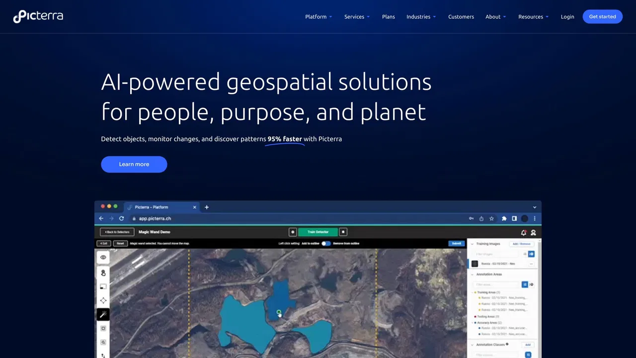
| 2 | Picterra | 562 | -74.8% | 39% 直接流量 | 免费试用,定价请咨询 | 对比 Picterra |
| 3 | Ultralytics | 79.34万 | +8.7% | 30% 直接流量 | 免费增值 | 对比 Ultralytics |
| 4 | DroneDeploy | 37.92万 | -5.9% | 72% 直接流量 | 免费试用,付费,定价请咨询 | 对比 DroneDeploy |
| 5 | Voxel51 | 11.77万 | -8.2% | 29% 直接流量 | 定价请咨询 | 对比 Voxel51 |
| 6 | Averroes AI Automated Visual Inspection | 1.43万 | -29.2% | 35% 直接流量 | 定价请咨询 | 对比 Averroes AI Automated Visual Inspection |

Picterra is a geospatial AI platform that turns satellite imagery into plot-level intelligence for commodity supply chains, covering crop yield risk, deforestation and EUDR compliance, carbon and regenerative agriculture monitoring.

免费 / 开源Voxel51 is the data platform for physical AI, built on the open-source FiftyOne library. It helps computer vision and robotics teams search, visualize, curate, annotate, and evaluate multimodal datasets — images, video, 3D scenes, and sensor streams — so they can find where models fail and fix the data behind them.
免费 / 开源Voxel51 is the data platform for physical AI, built on the open-source FiftyOne library. It helps computer vision and robotics teams search, visualize, curate, annotate, and evaluate multimodal datasets — images, video, 3D scenes, and sensor streams — so they can find where models fail and fix the data behind them.
缺陷检测精度达 99% 以上的无代码 AI 视觉检测
缺陷检测精度达 99% 以上的无代码 AI 视觉检测
面向资源回收与包装设计的 AI 废弃物分析平台

Windward is a Maritime AI™ platform that fuses multi-sensor maritime data with behavioral analytics to deliver mission-grade, all-source operational intelligence for defense, government, and commercial organizations.
Windward is a Maritime AI™ platform that fuses multi-sensor maritime data with behavioral analytics to deliver mission-grade, all-source operational intelligence for defense, government, and commercial organizations.

Netradyne is an AI-powered fleet safety platform built around the Driver•i camera system. It analyzes 100% of drive time with edge AI, delivers real-time in-cab alerts, scores drivers with the GreenZone Score, and helps fleets reduce collisions, exonerate drivers, and lower insurance pressure.
Netradyne is an AI-powered fleet safety platform built around the Driver•i camera system. It analyzes 100% of drive time with edge AI, delivers real-time in-cab alerts, scores drivers with the GreenZone Score, and helps fleets reduce collisions, exonerate drivers, and lower insurance pressure.