01
EOS Data AnalyticsOfficiel
720,8 k/mois
Des images satellitaires transformées en décisions par l'IA
IA pour l'analyse de donnéesNote de la rédaction : 4.2Tarifs sur demande31% direct

Tarifs sur demande

12 alternatives à FlyPix AI, sélectionnées selon leurs fonctions et usages.
| Classement | Outil & Slogan |
|---|
| Domaine officiel |
|---|
| Visites mensuelles |
|---|
| Croissance mois sur mois (MoM) |
|---|
| Modèle de tarification |
|---|
| Marché principal |
|---|
| Note |
|---|
| Comparer |
|---|
| ● | FlyPix AI | flypix.ai | 86,42 k | 11,04 k (+14,6 %) | Freemium, Essai gratuit, Payant | Brésil | 4,3 | Profil |
| 1 | EOS Data Analytics | eos.com | 720,76 k | -146,24 k (-16,9 %) | Tarifs sur demande | Brésil | 4,2 | Comparer |
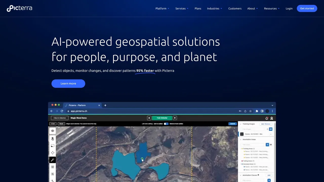
| 2 | Picterra | picterra.ch | 562 | -1,67 k (-74,8 %) | Essai gratuit, Tarifs sur demande | États-Unis | 4,3 | Comparer |
| 3 | Ultralytics | ultralytics.com | 793,42 k | 63,49 k (+8,7 %) | Freemium | Chine | 4,6 | Comparer |
| 4 | DroneDeploy | dronedeploy.com | 379,21 k | -23,89 k (-5,9 %) | Essai gratuit, Payant, Tarifs sur demande | États-Unis | 4,6 | Comparer |
| 5 | Voxel51 | voxel51.com | 117,72 k | -10,48 k (-8,2 %) | Tarifs sur demande | États-Unis | 4,5 | Comparer |
| 6 | Averroes AI Automated Visual Inspection | averroes.ai | 14,29 k | -5,89 k (-29,2 %) | Tarifs sur demande | États-Unis | 4,2 | Comparer |
| 7 | Viso Now | viso.ai | 111,15 k | -3,38 k (-3 %) | Freemium, Tarifs sur demande | États-Unis | 4,4 | Comparer |
| 8 | Greyparrot | greyparrot.ai | 7,48 k | -1,21 k (-13,9 %) | Tarifs sur demande | États-Unis | 4,4 | Comparer |
| 9 | Windward Maritime AI | windward.ai | 128,78 k | -78,99 k (-38 %) | Tarifs sur demande | États-Unis | 4,7 | Comparer |
| 10 | Netradyne | netradyne.com | 470,4 k | -28,36 k (-5,7 %) | Tarifs sur demande | États-Unis | 4,4 | Comparer |
| 11 | Pl@ntNet | plantnet.org | 439,9 k | 113,88 k (+34,9 %) | Gratuit | États-Unis | 4,6 | Comparer |
| 12 | Lenso.ai | lenso.ai | 1,59 M | -21,27 k (-1,3 %) | Freemium | États-Unis | 4,2 | Comparer |
Des images satellitaires transformées en décisions par l'IA

Picterra is a geospatial AI platform that turns satellite imagery into plot-level intelligence for commodity supply chains, covering crop yield risk, deforestation and EUDR compliance, carbon and regenerative agriculture monitoring.
Picterra is a geospatial AI platform that turns satellite imagery into plot-level intelligence for commodity supply chains, covering crop yield risk, deforestation and EUDR compliance, carbon and regenerative agriculture monitoring.

Gratuit / Open sourceDes modèles de vision temps réel et une plateforme complète pour les entraîner, annoter et déployer
Gratuit / Open sourceDes modèles de vision temps réel et une plateforme complète pour les entraîner, annoter et déployer

Captation de la réalité, robotique et vision IA pour le monde construit
Captation de la réalité, robotique et vision IA pour le monde construit

Gratuit / Open sourceVoxel51 is the data platform for physical AI, built on the open-source FiftyOne library. It helps computer vision and robotics teams search, visualize, curate, annotate, and evaluate multimodal datasets — images, video, 3D scenes, and sensor streams — so they can find where models fail and fix the data behind them.
Gratuit / Open sourceVoxel51 is the data platform for physical AI, built on the open-source FiftyOne library. It helps computer vision and robotics teams search, visualize, curate, annotate, and evaluate multimodal datasets — images, video, 3D scenes, and sensor streams — so they can find where models fail and fix the data behind them.
Inspection visuelle par IA sans code avec plus de 99 % de précision
Inspection visuelle par IA sans code avec plus de 99 % de précision

D'une idée à une application de vision par ordinateur en direct, de façon agentique
D'une idée à une application de vision par ordinateur en direct, de façon agentique

Analyse des déchets par IA pour la valorisation matière et l'écoconception
Analyse des déchets par IA pour la valorisation matière et l'écoconception

Windward is a Maritime AI™ platform that fuses multi-sensor maritime data with behavioral analytics to deliver mission-grade, all-source operational intelligence for defense, government, and commercial organizations.
Windward is a Maritime AI™ platform that fuses multi-sensor maritime data with behavioral analytics to deliver mission-grade, all-source operational intelligence for defense, government, and commercial organizations.

Netradyne is an AI-powered fleet safety platform built around the Driver•i camera system. It analyzes 100% of drive time with edge AI, delivers real-time in-cab alerts, scores drivers with the GreenZone Score, and helps fleets reduce collisions, exonerate drivers, and lower insurance pressure.
Netradyne is an AI-powered fleet safety platform built around the Driver•i camera system. It analyzes 100% of drive time with edge AI, delivers real-time in-cab alerts, scores drivers with the GreenZone Score, and helps fleets reduce collisions, exonerate drivers, and lower insurance pressure.

Identifiez les plantes par photo et contribuez à la science de la biodiversité
Identifiez les plantes par photo et contribuez à la science de la biodiversité

Recherche d'images inversée par IA : visages, lieux, doublons
Recherche d'images inversée par IA : visages, lieux, doublons